
Plan your trip
The history of Molokini Crater, year by year
The short answer Molokini was a volcano, then a named place in Hawaiian tradition, and since 1977 a state-protected reserve. Boat limits, moorings and fees came in stages, and the sources disagree on some dates, so this timeline marks what is confirmed and what is not.
On this page
This is the dated version of Molokini's story. Each row says what happened and where the date comes from. For what the place means and why it is protected, read the Molokini history and meaning guide.
Timeline
| When | What happened | Confidence |
|---|---|---|
| Before written records | The volcanic cone forms. We state no age. | Shape confirmed by the state; age not stated |
| Before written records | Hawaiians know Molokini as a wahi pana and name it in creation chants. They fish there and gather birds and eggs. | State's note, undisputed |
| World War II | Molokini is used for target practice, and practice bombs destroy the 1911 navigation light. | A 2010 University of Hawaiʻi and Oregon State report for the state |
| After the war | The Navy detonates two large unexploded bombs inside the crater, damaging a large area of reef. Public outcry leads it to remove most of the remaining bombs. | Same report; no years given |
| 1977 | The state creates the Molokini Shoal Marine Life Conservation District. | Confirmed by DLNR |
| 1987 or 1995 | Commercial boat permits become limited. | Sources disagree on the date |
| 1995 | A university study dates moorings and the anchoring ban to this year. The state's 2023 briefing ties the 42-permit system to the 1995 rules. | Sources overlap but do not match |
| 2009 | A visitor survey finds over two-thirds felt crowded. | Confirmed in the state's 2023 briefing |
| 2010 | Nearly 300,000 people visit. | State briefing |
| 2015 | 334,036 visitors, and up to 1,702 on the busiest day. | State briefing |
| 2016 to 2017 | A study finds half of the bluefin trevally pushed out of their preferred shallow reef when more than 12 vessels are present. | Peer-reviewed study |
| 2020 | Tours stop during the pandemic. Fish biomass inside the district rises. | Peer-reviewed study |
| After 2020 | Visitors return and biomass falls back to pre-pandemic levels. The study does not give one date. | Peer-reviewed study |
| Dec 15, 2023 | The Land Board adopts new district and mooring rules. | DLNR |
| Jan 1, 2024 | Commercial mooring use is charged at $200 a month, waived for operators already paying the ocean stewardship fee. | Rule text |
| Mar 15, 2024 | The amended rules are compiled as in force today. | Rule text |
What the geology tells us
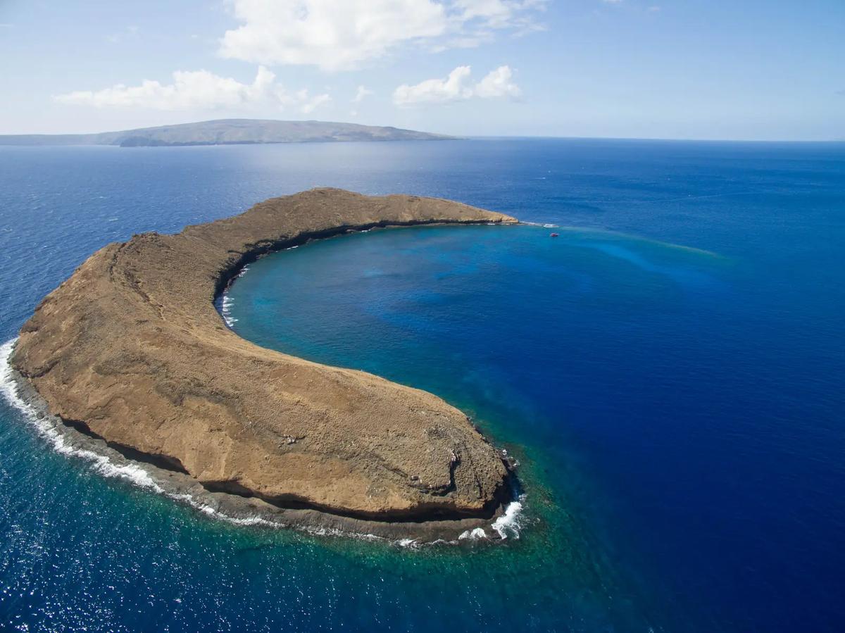
The state's description is brief: a horseshoe-shaped cone left from a volcano. The history guide has the shape and size. The page says no more than that, and the rule history below is the better-documented part of the story.
Traditional use
The state's note on Molokini is brief. It records a storied place, named in chants, used for fishing and for birds and eggs. Detailed accounts belong to Hawaiian cultural sources.
Wartime and ordnance reports
A 2010 University of Hawaiʻi and Oregon State report for the state says the navigation light installed in 1911 was put out during World War II for security. Practice bombs later destroyed it, because the military used Molokini for target practice.
After the war, the report says, the Navy detonated two large unexploded bombs inside the crater. That damaged a large area of reef, and the report says the damage can still be seen. Public outcry led the Navy to remove most of the remaining bombs. The report gives no years for the detonations.
1977 and what the district covers
The 1977 district covers about 77 acres of water. It has two subzones. Subzone A is the crater's inner waters. Subzone B reaches 100 yards outside. Nothing may be taken inside the crater. Outside it, trolling for finfish is allowed. Black coral, once common in deeper water, was heavily harvested, and small colonies remain on the back wall.
Permits, moorings and fees
Permits are per boat. Under the current rules they expire on December 31 of every odd-numbered year and are reissued only to existing permit holders. Renewal fees now run in three tiers by passenger count.
Before 2024 the fee was $50 for a two-year permit, according to the Land Board's 2023 briefing.
The system began with 42 permits and 2 were not renewed, which leaves about 40 in the state's 2023 count. The state does not publish the holder list.
On a day-use mooring, a boat may stay 2.5 hours at most. Commercial use needs a permit addendum, and moorings go first come, first served. A 2013 to 2015 study counted 26 state buoys in Subzone A. The 2024 rules dropped the old mooring zones, and we found no current count.
Traffic over time
Counts rose from nearly 300,000 in 2010 to 334,036 in 2015. A 2009 survey found that over two-thirds of visitors felt crowded, and the state's peak period is 8:30 to 10:30 a.m.
The 2020 shutdown was a natural test. Fish biomass inside the district rose quickly while tours were off and fell back once visitors returned. The study ties the rise to the drop in tours. Reef manners are in the sustainable snorkeling guide.
What we could not confirm
- An age for the islet. Not stated.
- Wartime and clean-up years. The report gives none for the detonations or the bomb removal.
- Early survey and mapping dates. No dated primary source found.
- Which year limited entry began. The sources give 1987 and 1995.
- A current mooring count. The 2024 rules require the state to publish a list, and we did not find one.
If you can point to a primary source for any of these, tell us and we will check it.
Why dates differ
Rules here were written in layers. A permit limit came first, then moorings, then a fee change and a rewrite in 2023 and 2024. State briefings, rule text and academic papers each describe that sequence from a different angle, and they do not always pick the same year. We give the rule text priority when it speaks, and name the range when it does not.
Each row above says whether it comes from a state page, the rules themselves, a published study or a report we could not confirm. If you plan to cite this timeline, check the linked state sources, not our summary.
Keep reading
Sources and corrections
The 9 sources for this page
- Maui Offshore Islet Seabird Sanctuaries (Hawaiʻi DLNR, DOFAW), read . Backs: Molokini is the southern rim of an extinct volcanic crater, a tuff cone of Haleakalā.
- Board of Land and Natural Resources, 7 Dec 2023, Item F-2: final approval of HAR 13-31 / 13-257 amendments (Hawaiʻi DLNR), read . Backs: Molokini is a wahi pana named in creation chants; traditional uses included fishing and bird and egg collecting.
- Maui – Molokini Shoal (HAR 13-31) (Hawaiʻi DLNR, Division of Aquatic Resources (DAR)), read . Backs: The district was established in 1977. · The district covers about 77 acres. · Black coral was heavily harvested; small colonies remain.
- Board of Land and Natural Resources, 26 May 2023, Item F-4: DAR/DOBOR briefing on Molokini rule amendments (with exhibits) (Hawaiʻi DLNR), read . Backs: About 40 permits remain active; 42 were issued at the start. Start dates differ between sources. · Visitor numbers: nearly 300,000 in 2010; 334,036 in 2015; up to 1,702 in a day. · 2009 survey: over two-thirds felt crowded. · A 2016-2017 study found half the bluefin trevally displaced above 12 vessels. · Peak crowding is 8:30 to 10:30 a.m.
- HAR chapter 13-31, Molokini Shoal MLCD, Maui (amended and compiled, effective 3/15/2024; unofficial copy) (Hawaiʻi DLNR), read . Backs: Permits are per boat, expire 31 December of odd-numbered years, and renewal fees are tiered by passengers. · Subzone A is the crater's inner waters; Subzone B reaches 100 yards outside. · No taking of marine life, except trolling for finfish in Subzone B. · Rules adopted Dec 2023, compiled as of 15 March 2024.
- HAR chapter 13-257, Day-Use Mooring Rules (amended and compiled 3/15/2024) (Hawaiʻi DLNR, Division of Boating and Ocean Recreation (DOBOR)), read . Backs: Mooring rules: 2.5 hours, commercial permit addendum, first come first served. · Mooring fee from 1 January 2024.
- Filous et al. (2017), Marine Pollution Bulletin 121:274-281, study of reef predators and crowding in the Molokini MLCD (University of Hawaiʻi at Mānoa + DAR Maui). Read in full as Exhibit 2 of BLNR Item F-4 (May 2023): https://dlnr.hawaii.gov/wp-content/uploads/2023/05/F-4.pdf (University of Hawaiʻi at Mānoa / Hawaiʻi DLNR DAR), read . Backs: 26 day-use buoys in Subzone A in the 2013-2015 study period.
- Weng et al. (2023), PLOS ONE 18(4): e0283683, 'Decreased tourism during the COVID-19 pandemic positively affects reef fish in a high use marine protected area' (co-authors from UH Mānoa and DLNR DAR). Read in full as Exhibit 3 of BLNR Item F-4: https://dlnr.hawaii.gov/wp-content/uploads/2023/05/F-4.pdf (UH Mānoa / Hawaiʻi DLNR DAR / VIMS), read . Backs: Fish biomass rose during the 2020 shutdown and fell back after.
- Marine Recreation at the Molokini Shoal MLCD, final report (Szuster and Needham, University of Hawaiʻi and Oregon State University, for the Hawaiʻi Division of Aquatic Resources, July 2010), p. 3 (University of Hawaiʻi at Mānoa / Oregon State University for Hawaiʻi DAR), read . Backs: Navigation light put out in World War II and later destroyed by practice bombs; Navy detonated two large unexploded bombs in the crater after the war; most remaining bombs removed.